


1
2
3
4
5
6
7
8
9
10

I-10 & CONGRESS/ST. MARY'S ROAD
JIMMIE KERR BOULEVARD
Inspiration for this project came from the pottery found at the Casa Grande Ruins National Monument. Rich blues, alluvial patterns, and ollas celebrate Indigenous irrigation technology.
PROJECT LOCATION MAP
STATE ROUTE 87
Cotton, one of our state’s “Five C’s,” remains one of Southern Arizona’s — especially Eloy’s — top agricultural crops. Structure aesthetics include verdant crop lines and cotton bolls.
RUTHRAUFF ROAD
John Mosheim Ruthrauff was an engineer credited with turning Tucson from a sleepy town with dirt streets into a modern city with paved roads and streetlights.
MIRACLE MILE
Six vivid murals, made of 18,000 hand-painted tiles by local artist Gary Lee Mackender, envision perspectives of Tucson and are exhibited on the retaining walls.
SPEEDWAY BOULEVARD
At the city’s “gateway to the University of Arizona,” depictions of the Steward Observatory, McMath-Pierce Solar Telescope, and the Kitt Peak National Observatory illustrate astronomy’s regional significance.
ST. MARY'S ROAD
Local artist Steve Farley portrays residents of the adjacent Barrio Hollywood and Barrio Anita with community-oriented photographic murals displayed on the retaining walls.
I-10/I-19
Many ethnic groups have inhabited the area in which this TI was built. Each has grown corn, beans, squash, and sunflowers monumentalized by the towering formliner design.
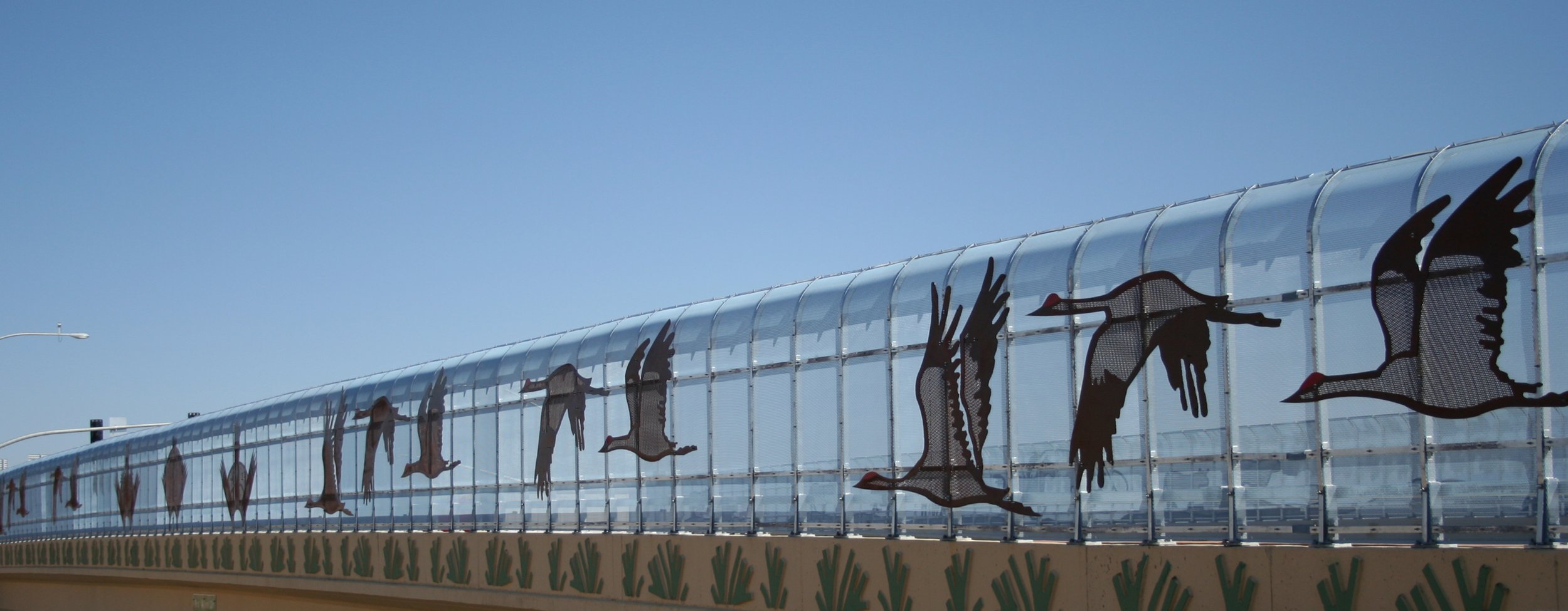
FORT GRANT ROAD
Following sandhill crane migrations to the Wilcox Playa every winter, bird enthusiasts and ecotourists also flock to Southern Arizona to experience our incredible avian biodiversity.